top of page

Forecasts


Australia Enters a Dual-Extreme Weather Phase as Cyclone Flooding Dominates the North and Heat and Fire Risk Dominates the South
During the recent major weather period, Tropical Cyclone Koji crossed the Queensland coast to the south of Townsville, between Ayr and Bowen. The system delivered damaging winds extending south through the Mackay and Whitsundays region, along with widespread heavy rainfall that penetrated well into the Central Queensland interior.
Daily rainfall totals in the range of 50 to 300 mm were recorded across multiple districts, with locally higher totals in areas exposed to persist
Jan 12


High-Impact Rainfall Event Likely to Exceed Model Forecasts – NE Queensland
Tropical Low 12U continues to develop in the western Coral Sea and is tracking toward the northeast Queensland coast. While model guidance indicates a moderate risk of cyclone development late Friday into Saturday, the primary and most immediate threat is extreme rainfall, not wind intensity.
Jan 9

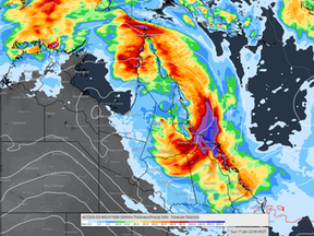
Australia Weather Outlook: Tropical Low 12U Drives Flood Risk in the North as Fire Danger Escalates Across the South
Australia is entering a high-impact weather period, with multiple hazards unfolding simultaneously across different regions. The national pattern remains sharply divided, with a developing tropical system bringing increasing flood and wind risk to the northeast, while extreme heat, dryness and escalating fire danger continue across the south and southeast. The lack of overlap between these regimes is critical, as there is no rainfall relief forecast for fire-prone southern re
Jan 8


High Energy Period 30 Dec – 11 Jan: National Multi-Hazard Flooding and Heat Event
Australia remains in an exceptionally high-energy pattern, with multiple hazards occurring simultaneously. The key theme through to the 11th is the continued dominance of the monsoon in the north and northeast, while dangerous heat and fire weather escalate across southern and western regions.
Jan 5


High-Impact Weather Nationwide: Flood Risk, Tropical Rainfall and Fire Danger Unfold
Satellite imagery 31.12.2025
Dec 31, 2025

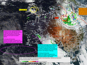
High Energy Period leads to extensive flood risk for
A prolonged weather event is expected to persist into 7–11 January 2026, continuing the active monsoonal pattern that has dominated since late December.
A key contributing factor lies in a series of Earth-facing coronal holes that developed during week four of December 2025, a phenomenon that was highlighted in previous Oz Industries Forecasting updates.
Dec 29, 2025


Australian Weather Weekly Update. HEP 18-24th followed by HEP 30.12.2025-11.1.2026
The High Energy Period (HEP) from 18 to 24 December is now moving through its peak phase. The 21 to 24 December window has proven to be the wetter segment of this period, with a marked increase in thunderstorm activity across the southeast over recent days.
Areas of southeast South Australia, Victoria, New South Wales and parts of southern Queensland have experienced a surge in storms, with recorded rainfall totals generally ranging from 5 to 50 mm, and isolated pockets of 5
Dec 22, 2025


High Impact - Severe Weather builds - late December into week 2 of January 2026
As the monsoon strengthens, high-impact rainfall is forecast to build across the northeast from late December, continuing into early January 2026, with the most intense period likely between 31 December and 11 January.
Dec 19, 2025


Australia Weather Outlook | Late December to January 2026
In today’s update, we unpack the next major weather cycle set to unfold from late December leading into the first tropical phase of the 2025–2026 season across northern Australia.
Expect a noticeable build-up of heat, moisture, and storm energy through the north and northeast, with high-impact rainfall likely developing into week two of January 2026.
Dec 16, 2025

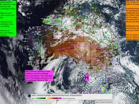
Weekly Weather Update - National Rainfall HEP 18-24th December
Monday 15 December to Sunday 22 December
This week is shaping up as a classic pre Christmas contrast across Australia.Heat dominates the north and interior, while the south experiences very strong winds, rough seas and sharp temperature swings. As we move toward 18 to 24 December, the atmosphere becomes more energetic, increasing the risk of severe thunderstorms and localised heavy rain, especially inland and across parts of the east.
Dec 15, 2025

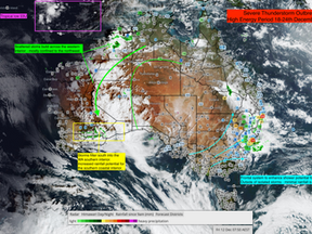
Australia Weekly Forecast - December 18-24th Wet Period Build Up
Australia is under a broad summer heat regime, dominated by a strong subtropical ridge and slow-moving trough.The northern tropics remain storm-active, the east coast faces sporadic storms leading to isolated heavy rain and localised flash flooding under a coastal trough, while the southern inland and west experience persistent heat and fire danger, punctuated by frontal wind surges and a cooler change early next week.
Dec 12, 2025

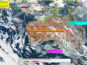
Australia: Weekly Weather & Fire Weather Outlook
Australia remains under a dominant heat regime this week, extending from the Pilbara and Interior through South Australia into inland NSW and Queensland. Maximums of 40–45 °C are widespread, accompanied by gusty north-westerlies and very dry air.
Dec 10, 2025


Weekly Weather Update 8.12.2025
How a failed spring and a moving drought corridor set the scene
Over the past few days, communities across New South Wales, Victoria and Tasmania have been hit by fast moving bushfires that have destroyed homes, cut roads and forced evacuations.
In New South Wales, a natural disaster has been declared after almost forty homes were lost across several local government areas, including the Central Coast, Mid Coast, Upper Hunter, Muswellbrook, Warrumbungle and Dubbo.
Dec 8, 2025


November 2025 Rainfall Deciles Confirm Peak Spring Rainfall and Emerging Southeastern Drought Risk as Tropical Cyclone Genesis Builds in the West
The pattern ahead sets the stage for the next High Energy Period, focused primarily over the western basin from 8–12 December. Current model guidance indicates Cyclone Genesis near 112–114° E, with the system expected to drift south toward the Pilbara coast by mid-month.
Secondary tropical lows are likely to form across the Arafura Sea and near 160° E between Vanuatu and New Caledonia, each forecast to track southeastward.
Dec 1, 2025

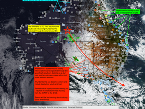
High Energy Period 28–30 November: Severe Storms, Heat & Fire Weather
28 November 2025 Severe Weather & Heatwave Overview
Nov 28, 2025


Cyclone Fina Peaks – Extreme Heat and Severe Storms Spread Nationwide
The current High Energy Period (19–24 November) reaches its peak today, coinciding precisely with the maximum intensity of Severe Tropical Cyclone Fina. The system is now beginning to weaken and will continue tracking southwest towards the North Kimberley coast and Mitchell Plateau from 25 November onwards.
Nov 24, 2025


Weekend Weather Update 21.11.2025
A highly dynamic national pattern is unfolding, driven by Tropical Cyclone Fina across the northern Top End, widespread severe heat across inland Australia, and increasing thunderstorm activity along the eastern seaboard.
Nov 21, 2025

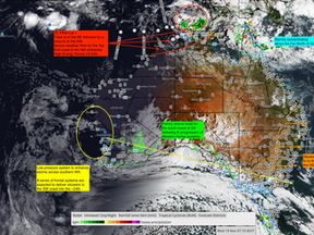
Tropical Cyclone Fina Update – Alignment with the 19–24 November High-Energy Period
Tropical Cyclone Fina Update – Alignment with the 19–24 November High-Energy Period
Nov 19, 2025

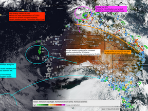
High Energy Period 19-24th Intensifies: Tropical Low 02U and the Escalation of National Severe Weather
High Energy Period 19-24th Intensifies: Tropical Low 02U and the Escalation of National Severe Weather
Nov 17, 2025

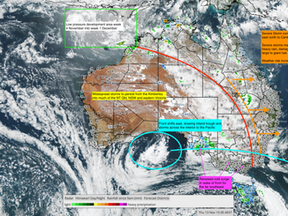
Australia Climate & Weather Briefing – Mid November 2025
Australia Climate & Weather Briefing – Mid November 2025
Nov 13, 2025
bottom of page